After having spent a fascinating day walking the Saxon Walls of Wareham, I was excited to share it in a new blog.
Before moving to Wareham in August 2019, we spent many a family holiday in the region visiting family and going to the seaside.
When driving past on the way to Swanage it was difficult to miss the monumental Saxon ‘earth walls’ as we drove past. However, with children in tow excited to play on the beach, taking a walk on the Saxon Walls of Wareham was not something high up on the week’s itinerary!
The walls were built in Saxon times to defend the town from the Vikings.
Wareham Walls Walk
The length of the walk is 1 mile which equates to a walking time of approximately 45 minutes. However, the walk will take longer depending on whether you stop for an ice cream and a boat trip at Wareham Quay, which is exactly what my Mum and I did. And very enjoyable it was too!
To get to the beginning of the walk from the Spurwing Guest House, it is approximately 10/15 minutes.
In October 2013, Wareham and District Development Trust kindly placed information boards along the way explaining the story of Wareham and its famous Saxon Walls of Wareham through the centuries.
Within this blog post, I will give route directions from the Spurwing Guest House and summarise some of the information learnt from reading the boards in preparation for your enjoyable walk.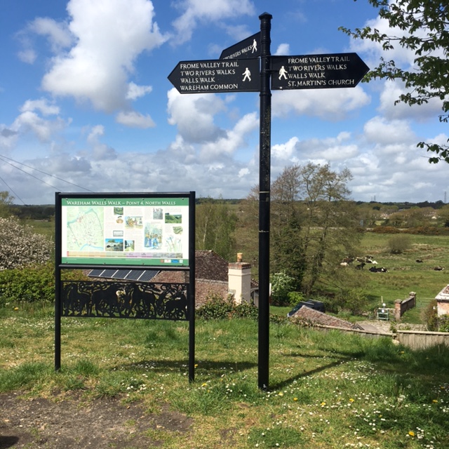
Our Route From Spurwing Guest House
1. From the driveway, take a right turn towards the train station. When you get to the train station take the walkway over the track. Go straight on, under the subway and keep walking towards North Bridge. Once over the bridge walk straight on until you see a road on the right called ‘Shatters Hill’.
2. Turn up ‘Shatters Hill’ and the Walls Walk starts here.
In terms of accessibility, there are slight slopes to get on the walls, but once on the top, the walk is fairly level and benches are provided to take in the view.
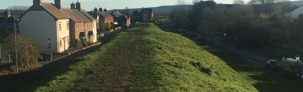
3. You will see a pathway which will take you on to ‘North Wall’. Below you can see Wareham Common and an old house beside the river. This house is North Mill on the River Piddle. It was first recorded in 1150 and it was a working mill up until the late 19th Century.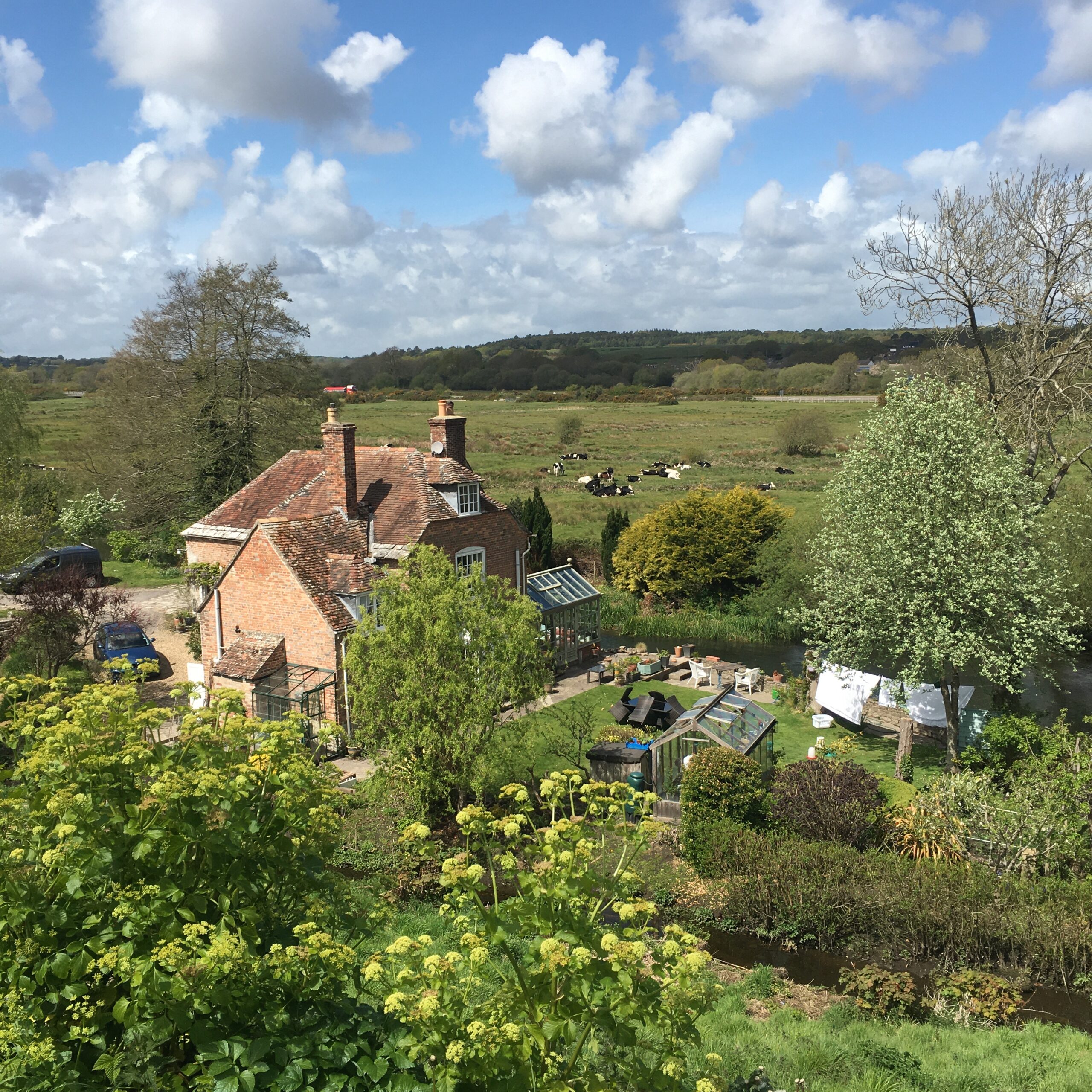
 Interestingly situated between the Rivers Frome and River Piddle, at the head of Poole Harbour, Wareham’s history stretches back over 2000 years.
In 700, a large Saxon community settled in Wareham which grew into one of the most important towns in the county.
Due to Wareham’s status and strategic location, many Viking raids were staged in the area. This led to King Alfred the Great commanding walls to be built around Wareham in 875. The town was fortified by the time the Vikings came in 876.
The ‘earth walls’ which enclose Wareham on three sides today: North Wall, East Wall and West Wall are the remains of these defences. The River Frome was the defence on the South side.
4. The wall bends left onto ‘West Wall’. As you walk along here, imagine the view to the right;
During the first World War 1914-18, there was a semi-permanent military camp with up to 7000 troops, including hundreds of Australian troops. The soldiers were stationed and trained here. The camp relocated to Bovington in 1922 and is still there today.
The popular Tank Museum is in Bovington. Based on our guest reviews, it is one of our ‘5 Top Tourist Attractions within 10 miles’ of our Dorset b&b.
A bit of gruesome history. This stretch of the wall was also known as ‘Bloody Bank.’ In 1213 and again in 1685, there were two episodes of hanging which you can read about on the information board close to the site.
5. At the end of ‘West Wall’, cross over the road and straight ahead you will see the Town Pound on Pound Lane. This was originally built, dating back to the year 800, to hold stray or impounded farm animals. Most medieval villages had one. The owner of the stray animal had to pay a fee to release it!
If you look closely you can see a black hook attached to the back wall that animals were once tethered to.
6. Walk down Pound Lane and look out for a large impressive Edwardian house with black gates on the right-hand side with a sign ‘Castle Close and Pound Lane’. This is the site of Wareham Castle! The house covers the remains of what had been an important and high-class royal castle.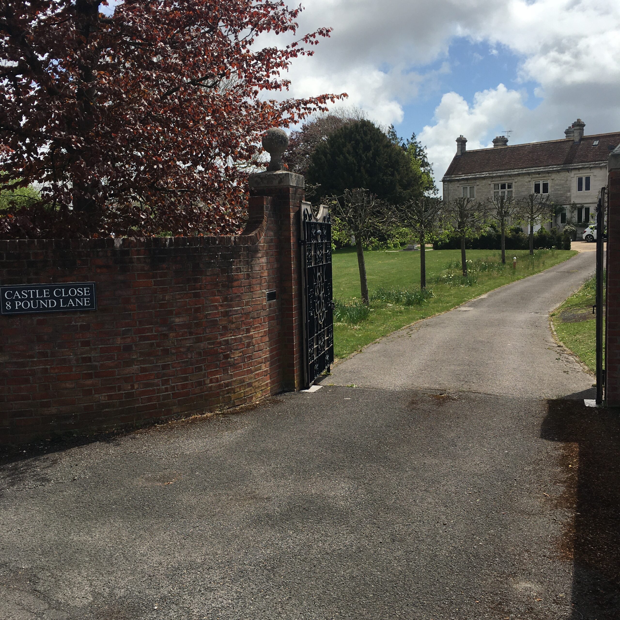
In 1066, Wareham was the largest town in Dorset and the main county port. In 1086 many houses were destroyed, probably forcibly seized, to make way for the construction of this motte and bailey castle for William the Conqueror. It was completed by 1110. It measured 70 feet square with walls up to 13 feet thick.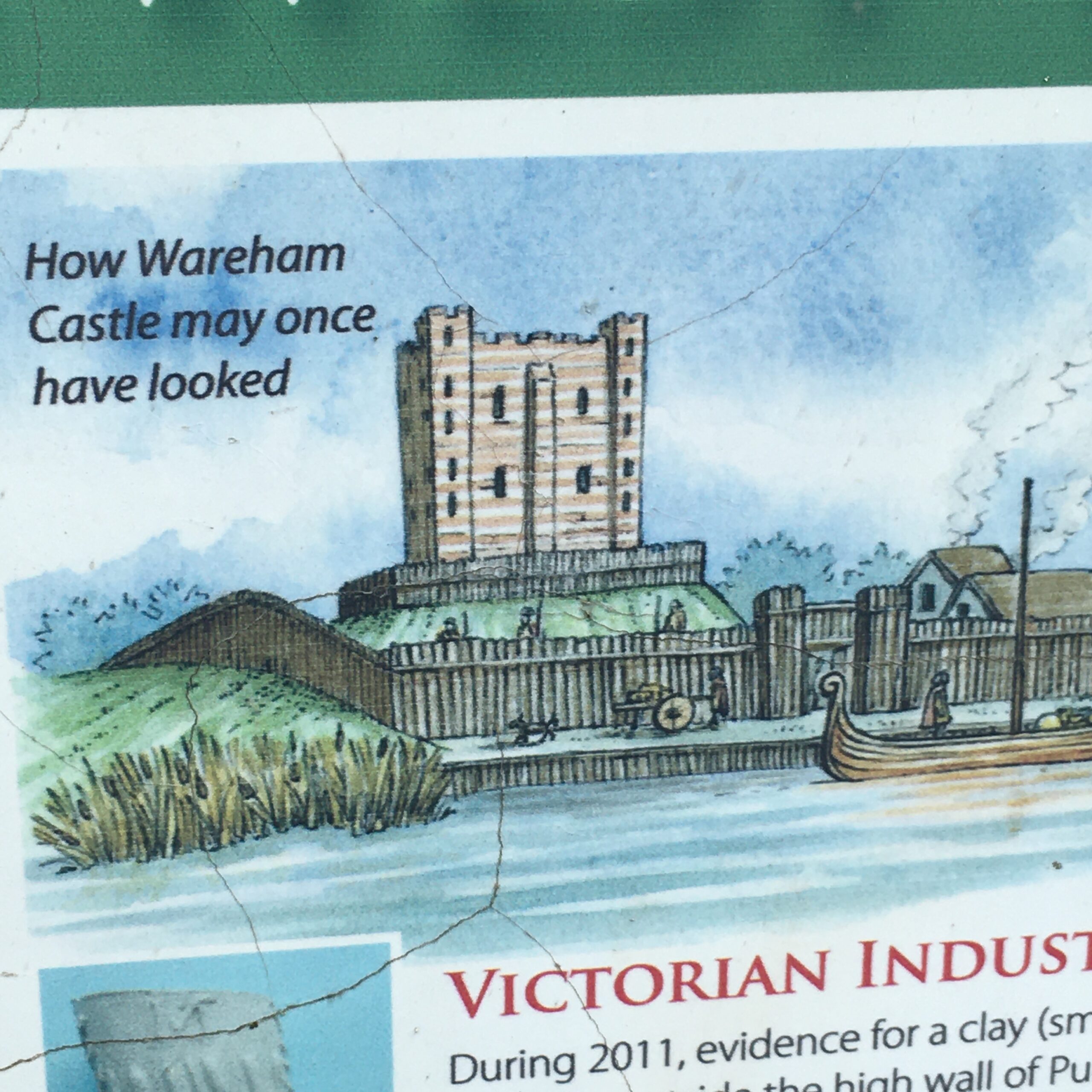
During the 12th Century Civil War, the castle was the focus of much fighting. It’s defensive position was insecure and led to its decline and abandonment. It was last used by Edward 1 and then sold by Elizabeth 1 in 1584.
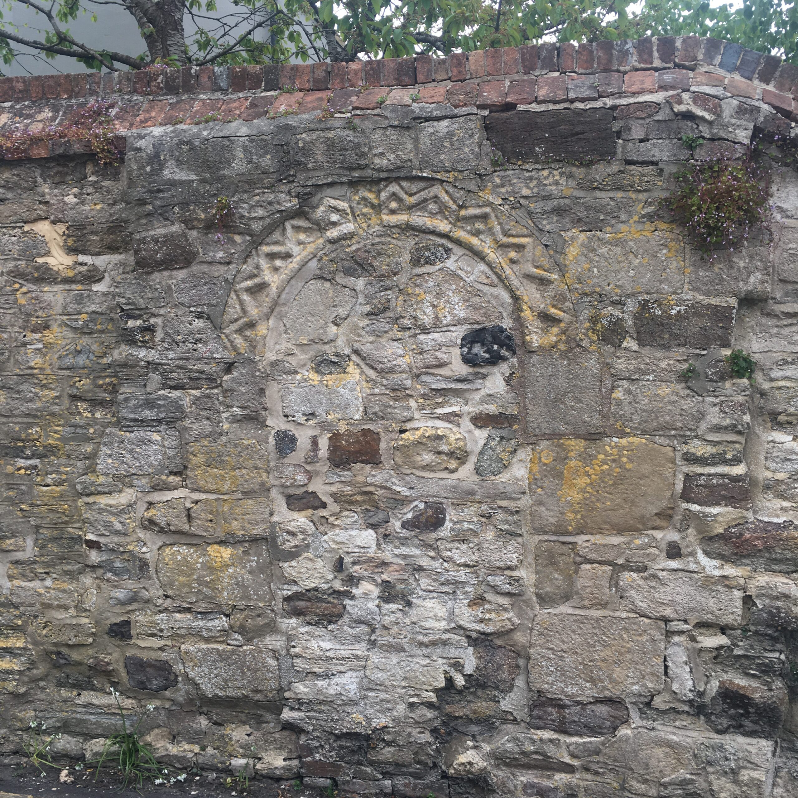
7. Further down on the left-hand side in the rectory wall there is part of an archway. This is believed to be from Wareham Castle.
Close by, also look out for the former Wareham Brewery.
In 1836 the brewery was destroyed by an arson attack from agricultural labourers with a hatred for machines, landowners and farmers. These attacks were common around England from the 1830s until the 1850s. Both properties were rebuilt and the Townsend family, who were the owners, were still in Pound Lane in 1841.
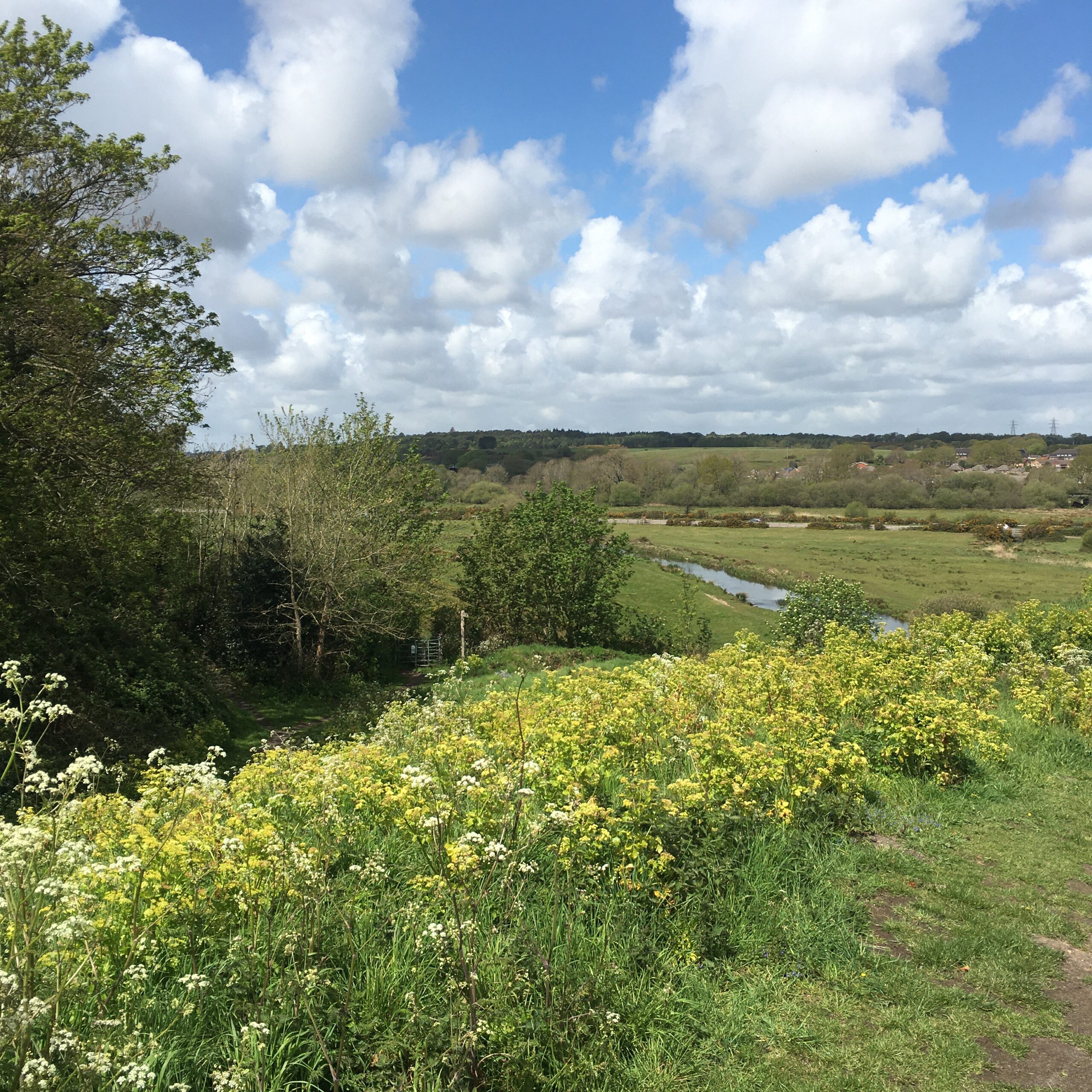
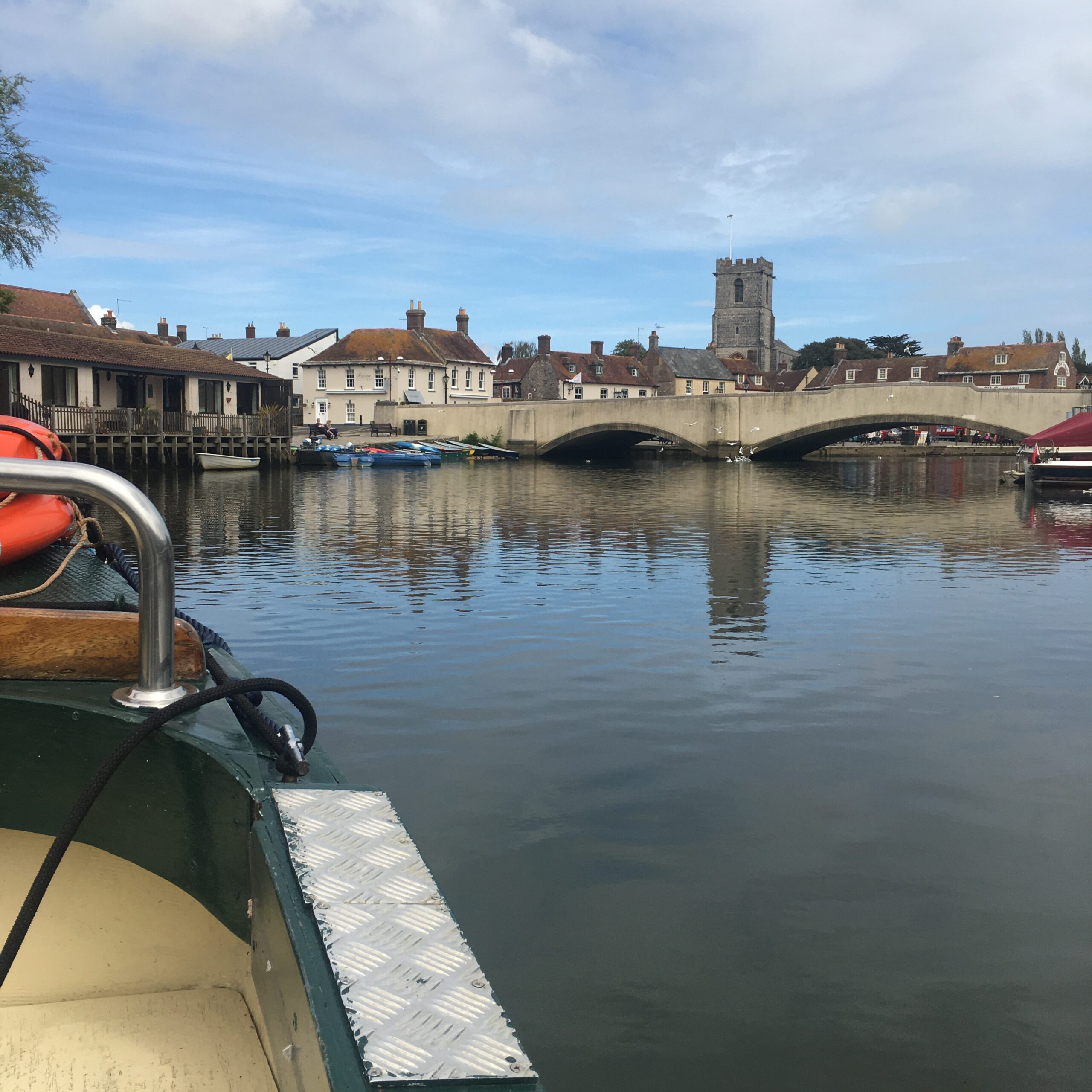
8. Take the next right onto Tanners Lane and approach the River Frome. Cross over South bridge and here you are at the popular Wareham Quay. Spend some time soaking up the atmosphere. Have a drink, a snack or maybe an ice cream and enjoy the view of the River Frome and the Purbeck Hills in the distance.
9. How about a boat trip on Orca? 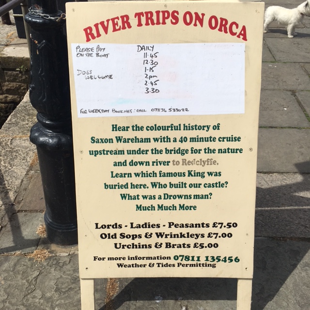
We went on a 40-minute trip along the River Frome. On board we had the best view of the Edwardian house and garden where Wareham Castle was originally sited.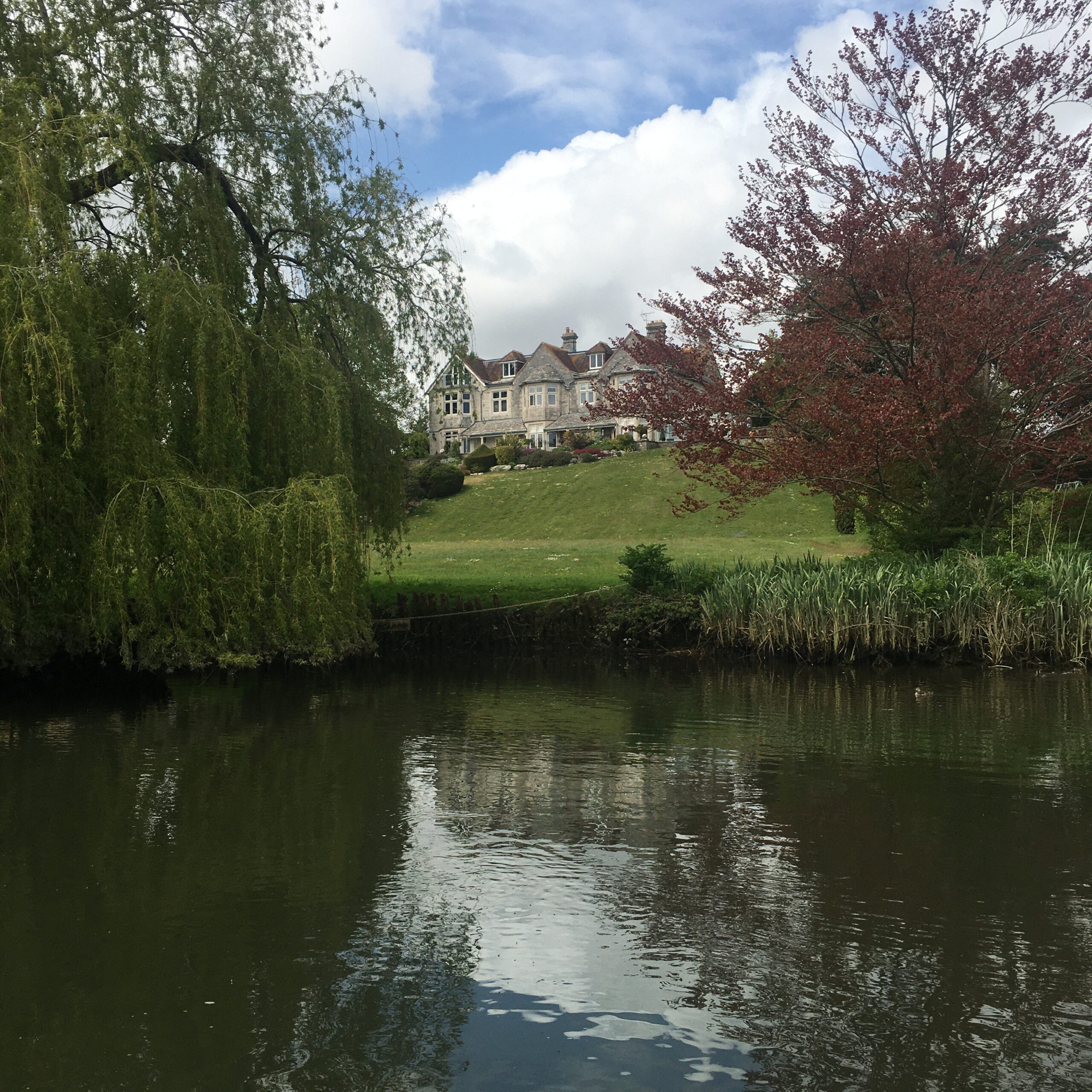
The ‘earth wall’ on which the castle would have stood was clearly visible from the boat.
The boat tour guide knowledgeably talked throughout the trip. One interesting fact was the murder of the young 15-year-old Saxon King Edward the Martyr in 978.
On his way to Corfe Castle to visit his half-brother and stepmother, he was tragically intercepted by assassins. As stories go, he was a victim of his stepmother who wanted her own son Ethelred the Unready to the rule the throne, which he did immediately afterwards!
Edward the Martyr was buried in The Church of Lady St Mary, which can be seen in the picture. His remains were removed shortly afterwards and reburied at Shaftesbury Abbey.
10. After the boat trip, take the path to the right of the Quayside Barn. Here you will find The Church of Lady St Mary.
11. On the corner ahead you will see a pretty thatched cottage.
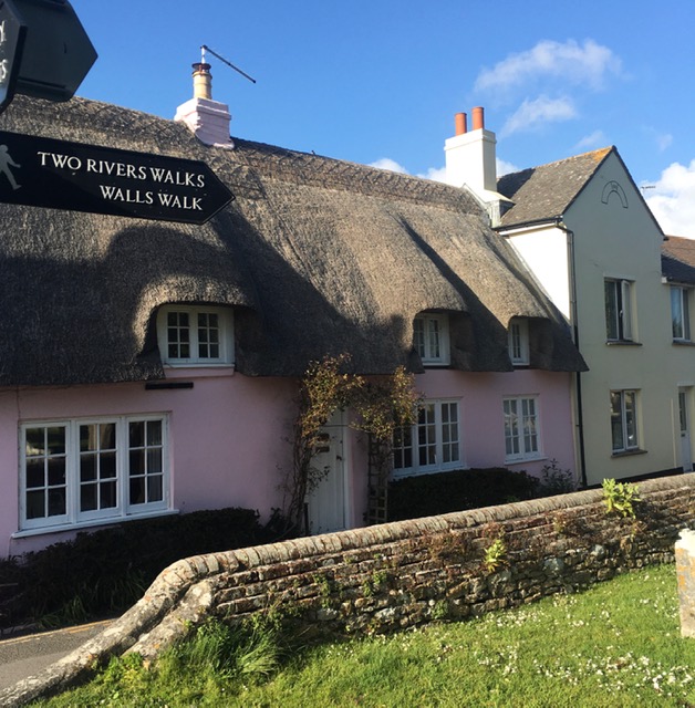 A few thatched houses that survived the Great Fire of Wareham in 1762 still remain today, including The King’s Arms in North Street and the one above.
12. From the pink thatched cottage, follow the signs through the cemetery and take a left turn. Keep going and you will see a path on to the ‘East Wall’.
13. You will walk past a small rectangular grassy area bounded by low banks. This has been known as the ‘Bowling Green’ for centuries. It appears large enough for a game of bowls, a little bumpy though! It may have been used for archery practice.
14. The next signs will lead you off the Saxon Walls of Wareham to the final stop on the walk to St Martin’s Church. It has a Saxon exterior and is the most complete Saxon church in Dorset believed to date from around 1020.
If you would like to read more about Saint Martin’s Church or Lady Saint Mary’s Church mentioned earlier, you can do so in our blog, ‘5 Local Churches in Dorset’.
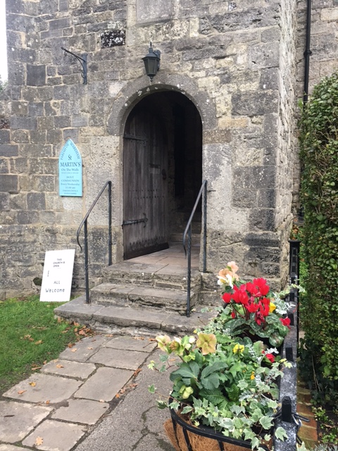
After the Great Fire of Wareham in 1762, several residents who lost their homes sheltered here.
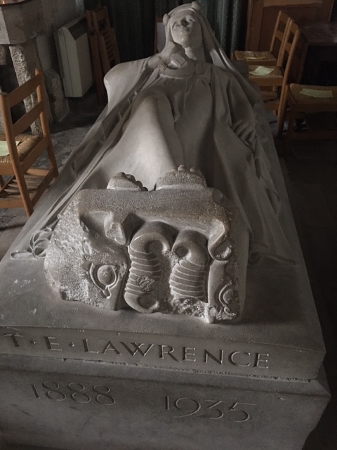
Inside there is also a stone memorial of Lawrence of Arabia (1888 – 1935), scholar, soldier, airman and diplomat, who died after a motorcycle accident at nearby Bovington.
 His rural retreat ‘Clouds Hill’ is owned by the National Trust. Please refer to our blog ‘TE Lawrence’s time in Dorset’.
This brings us to the end of the Wareham Walls Walk!
To return to Spurwing Guest House, head back over the North Bridge, then through the subway, over the railway track crossing, take a right, under the bridge and continue to Sandford Road to the Guest House.
We have copies of the map and route directions at Spurwing Guest House.
We hope you can come and visit us and enjoy exploring and learning about the Saxon Walls of Wareham as much as we have!
If you enjoyed reading this blog and would like to learn about updates, events in the area or last-minute availability at our Dorset B&B, Spurwing Guest House, you can subscribe to our mailing list.


